|
The National Oceanic and Atmospheric Administration (NOAA) formed the National Centers for Coastal Ocean Science (NCCOS) in 1999 as the focal point for NOAA’s coastal ocean science efforts. We provide coastal managers with the scientific information necessary to decide how best to protect environmental resources and public health, preserve valued habitats, and improve the way communities interact with coastal ecosystems.
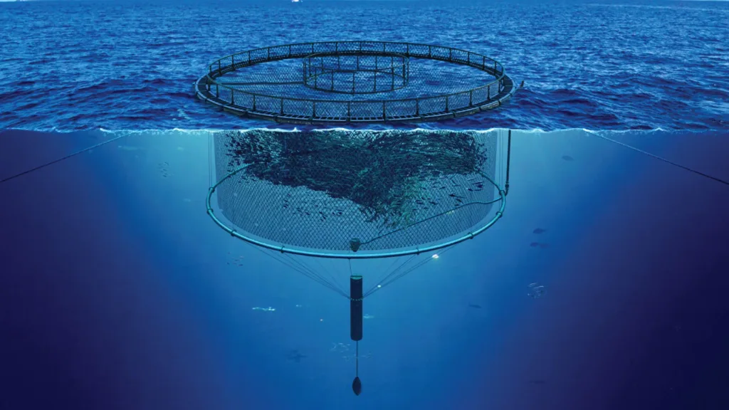
Spatial Planning Supports Siting of Two New Aquaculture Operations in the Gulf
The National Centers for Coastal Ocean Science (NCCOS) continues to support efforts to boost the domestic production of seafood and streamline permitting of aquaculture in the United States. By leveraging spatial modeling expertise, NCCOS conducts technical siting studies to identify the most suitable and optimal locations for aquaculture development in U.S. waters. Continue reading
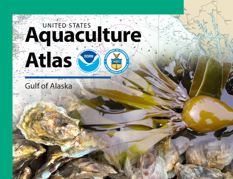
NCCOS Maps Options for Aquaculture Opportunity Areas in Gulf of Alaska
NCCOS has released an Atlas that compiles the best available science to inform the identification of Aquaculture Opportunity Areas (AOAs) in the Gulf of Alaska. The publication identifies 77 AOA options in 10 study areas with the potential to support multiple commercial seaweed and shellfish aquaculture operations in Alaska state waters. Continue reading
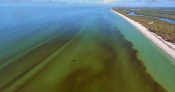
New DNA-Based Method Enables Sensitive, Species-Specific Detection of Red Tide Microalgae
Reliable detection of harmful algal species is essential for understanding how red tide blooms form, tracking their movement, and developing strategies to manage them. In a new study, researchers developed and tested a real-time DNA-based method that can accurately detect as little as a single cell of Karenia brevis, the toxic dinoflagellate responsible for frequent red tide blooms impacting Gulf Coast communities from Texas to Florida. Continue reading
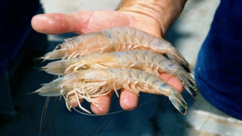
Study Uncovers Multidecadal Drivers of Louisiana's Shrimp Distributions
Shrimp is one of the most valuable and plentiful commercial fisheries in Louisiana, but locating aggregations of shrimp in numbers high enough to harvest takes a lot of effort. New research findings could help change that, making it easier for shrimpers to find shrimp. Continue reading
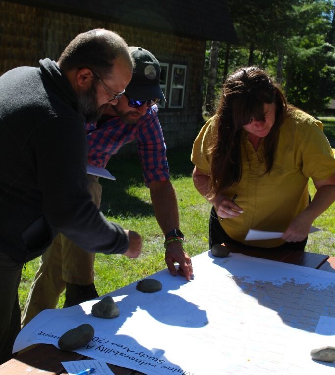
New Community Risk Assessment Available for Rural Maine
The NCCOS social science team has published a methods report, data archival package, and mapbook for a new assessment identifying where communities in Maine’s Washington County and the Greater East Grand Region are most at risk from coastal and inland natural hazards.
Continue reading
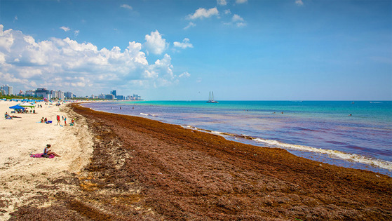
Detecting Chemical Contaminants within Sargassum Seaweed
NCCOS scientists are examining the presence of pollutants and trace metals within Sargassum seaweed found along Florida’s southeastern coast, Puerto Rico’s southwest and southeast coasts (Culebra), St. Thomas, and St. Croix. Continue reading
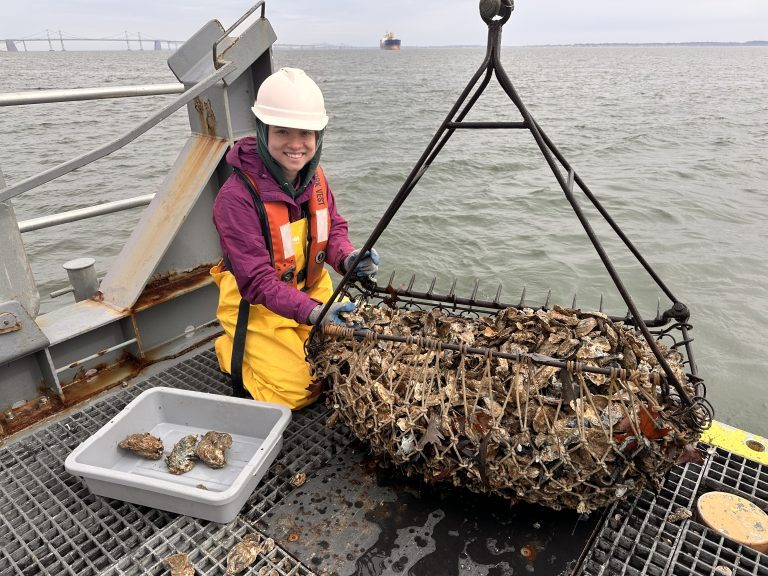
The Log Book: Meet the Collaborative Network Behind Collecting Bivalves for Chemical Analysis
Every year, the Mussel Watch Program (MWP) targets a specific region of the U.S. with a mission to collect bivalves — oysters or mussels — and a little bit of mud to assess the chemical health of our nation’s coastlines. This is not a small or trivial endeavor. No matter the region, the program works with a network of local agencies, programs, and volunteers to ensure that every data point collected has the maximum impact for communities that depend on these waters. Continue reading
Leveraging Computer Modeling to Understand and Manage the Gulf Ecosystem
Computer modeling is a valuable tool for investigating water movement, food webs, and other processes happening in the ocean. Projects funded by the NOAA RESTORE Science Program have leveraged advanced computer modeling to enhance understanding and management of the Gulf of America’s (formerly Gulf of Mexico’s) complex ecosystem. These models simulate interactions among species, habitats, and environmental factors, providing critical insights for resource managers. Continue reading
|